
Utility Avoidance Systems
e-Safe Service
Avoidance
For
Everyone.
Straightforward ground penetrating radar information for pre-excavation utility avoidance, without requiring conventional radargram interpretation.
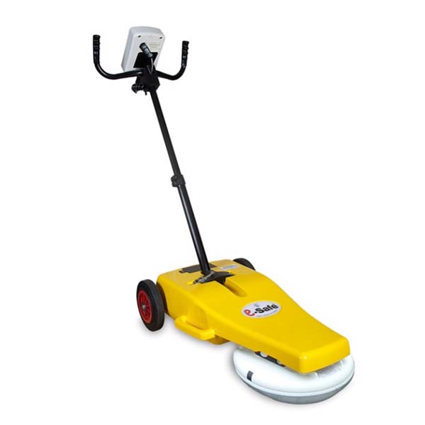
Two survey workflows e-Safe LOG for single-line collection. e-Safe PRO for up to five related survey lines.
No conventional radargram interpretation.
Conductive and non-conductive targets.
Logging and GPS-enabled records with LOG.
Compare up to five lines with PRO.
Why e-Safe
More subsurface information before breaking ground
e-Safe adds GPR-based information to established utility-avoidance procedures and helps operators identify locations requiring further investigation.
Detect beyond live conductive services
GPR responds to contrasts beneath the surface rather than requiring a utility to carry power or a detectable locating signal.
Identify metallic and non-metallic targets
Potential responses can include metallic services, plastic pipes, ducts, drainage, fibre routes, voids and disturbed ground, where site conditions permit.
Review processed information
The system presents a graded likelihood indication instead of requiring the operator to interpret a conventional radar profile.
Choose the required survey context
LOG provides a traceable single-line workflow. PRO adds the ability to compare up to five related survey lines and recognise continuing patterns.
Practical Workflow
Scan, review and investigate
e-Safe processes the radar response while the operator moves through the intended work area.
Scan the area
Move the system at walking pace across the proposed excavation area, using suitable survey directions for the expected target routes.
Review the indication
The interface processes returned signals and highlights locations where a potential target or subsurface anomaly may be present.
Investigate and verify
Consider the result alongside plans, electromagnetic locating, competent assessment, safe-dig procedures and physical verification.
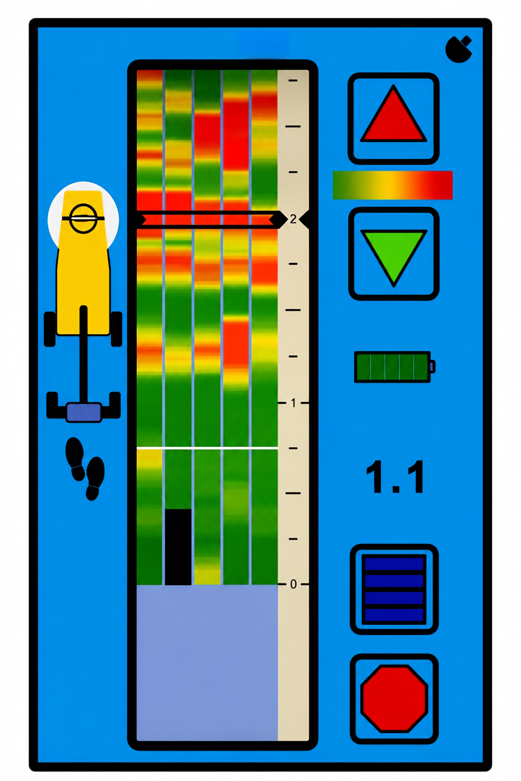
Operator Interface
Practical information rather than a conventional radargram
The purpose-designed display helps the operator review the likelihood of a subsurface target and return to areas requiring further investigation.
Graded likelihood indication
Different indication levels help distinguish stronger and weaker areas of interest.
Adjustable sensitivity
Operator-adjustable sensitivity supports use across different ground and target conditions.
Positioning and trackback
The operator can reposition the antenna over an indicated point for marking and further investigation.
Indicative depth support
Depth information may be available where the signal and site conditions provide sufficient data quality.
e-Safe Configurations
Same e-Safe platform. Different levels of survey context.
Select the workflow around the information required from the investigation rather than treating LOG and PRO as completely different machines.
e-Safe LOG
Traceable single-line utility avoidance
Collect and review one survey line while retaining a GPS-enabled record of where, when and how the equipment was used.
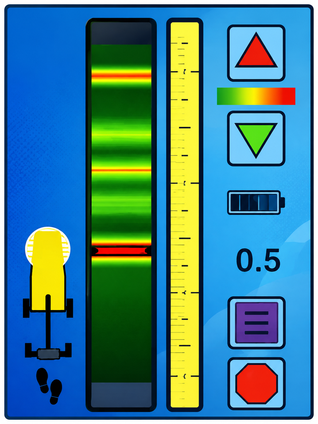
One survey line provides one view across the work area.
- Single survey-line collection
- Graded likelihood indication
- GPS-enabled automatic logging
- Downloadable usage records
- Four Chronos masking levels
- One-touch depth-estimation support
Routine pre-excavation checks, documented field use and straightforward single-pass investigation.
e-Safe PRO
Multi-line utility avoidance with enhanced pattern recognition
Collect and compare up to five related survey lines to identify whether responses continue across adjacent passes.
Five related lines provide more context across the work area.
- Up to five related survey lines
- Comparison across adjacent passes
- Improved recognition of continuing patterns
- More context around isolated responses
- Suitable for more complex work areas
- Built around the core e-Safe workflow
Congested sites and investigations where the operator requires more spatial context before further investigation.
One line versus five lines does not mean one utility versus five utilities
It refers to the number of related survey passes that can be reviewed together. A response appearing across adjacent lines is easier to recognise as a continuing subsurface pattern rather than an isolated anomaly.
Reference Technical Data
e-Safe LOG reference specification
- Antenna
- XPM2 X-polar bi-static dipole, 135–835 MHz, nominal centre frequency 485 MHz
- Reference detection range
- Approximately 50 mm below the surface to 2 metres, subject to ground conditions
- Sensitivity
- 16 operator-adjustable increments
- Chronos masking
- Four masking levels
- Display
- High-contrast 177 mm sunlight-readable portrait LCD
- Operating temperature
- −10°C to +50°C
- Battery
- Removable 14.4 V lithium-ion battery pod
- Downloadable log
- GPS coordinates, date, time, function, settings and depth information
Typical Applications
Utility avoidance before localised intrusive work
e-Safe is designed to add subsurface information before excavation, drilling, coring or other ground penetration.
Trial holes and excavations
Scan the intended excavation area before breaking the surface or opening a trial hole.
Highway and pavement works
Add GPR information before excavation, drilling or coring within roads, footways and paved areas.
Construction sites
Investigate defined work areas where existing plans may be incomplete or additional confidence is required.
Maintenance and repair
Support service connections, repairs and maintenance work where buried infrastructure may cross the work area.
Important Safety Information
e-Safe provides additional information, not excavation clearance
A displayed response does not identify the target material with certainty, and the absence of an indicated response does not prove that the ground is clear.
Results depend on the equipment configuration, ground conditions, moisture, target size, depth and orientation. e-Safe should be used alongside available records, electromagnetic locating, competent assessment, safe-dig procedures and suitable physical verification.
Frequently Asked Questions
Choosing and using e-Safe
Contact UTSI to confirm the current configuration, specification and suitability for the intended application.
What is the main difference between e-Safe LOG and e-Safe PRO?
Does LOG detect fewer utilities than PRO?
Which configuration should I choose?
Does e-Safe replace an electromagnetic cable locator?
Can e-Safe detect plastic pipes?
Does the operator need to interpret radargrams?
Select the Right e-Safe Configuration
Choose the level of survey context your work requires
Tell us about the intended work area, expected utilities, operating workflow and documentation requirements.