
GPR Application
Utility Avoidance
Add straightforward GPR-based information to the pre-excavation process and identify areas that may require further investigation before breaking ground.
Application Overview
More information before excavation
Utility avoidance is focused on reducing excavation risk at a specific work area rather than producing a detailed map of an entire utility network.
Scan the intended excavation area
GPR can be used across the proposed work area to identify responses that may indicate buried services or other subsurface changes.
Add information beyond electromagnetic locating
GPR responds to contrasts within the ground rather than relying on a conductive utility or an applied electromagnetic signal.
Identify areas requiring further investigation
A radar response can help direct additional locating, verification or careful excavation to the areas of greatest concern.
Support the wider safe-dig process
Results should be considered together with plans, records, electromagnetic locating, site inspection and appropriate physical verification.
Application Distinction
Utility avoidance is different from detailed utility mapping
Both applications use GPR, but the operating workflow, equipment, interpretation and required output are different.
Focused on excavation risk
Intended for checking a work area and identifying potential subsurface hazards before breaking ground.
- Rapid pre-excavation assessment
- Straightforward field workflow
- Processed target indication
- Limited requirement for radar interpretation
- Commonly associated with e-Safe
Focused on detailed survey information
Intended for locating, interpreting and recording utility routes across a wider survey area.
- Professional radar-data interpretation
- Single- or multi-channel collection
- Survey positioning and records
- Utility-route mapping
- Commonly associated with GroundVue
Featured Product
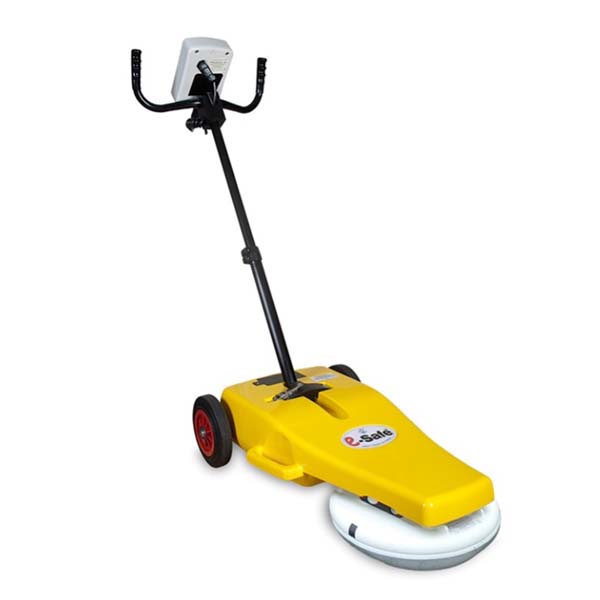
e-Safe makes GPR information more accessible
e-Safe is designed around the utility-avoidance workflow. The system processes the radar response and presents a practical indication of the likelihood that a service or other anomaly may be present.
- No conventional radargram interpretation required
- Push-along field operation
- Graded target-likelihood indication
- Supports metallic and non-metallic target investigation
- Intended to complement established locating methods
Potential Targets
GPR can respond to different buried materials and conditions
Detection depends on target size, depth, orientation, surrounding material, moisture and the electrical contrast within the ground.
Metallic services
Metallic pipes, cables and ducts generally produce a strong radar response where site conditions permit.
Plastic pipes
Plastic and other non-conductive services can produce a detectable response where sufficient contrast exists.
Fibre-optic routes
Fibre-optic cables, ducts and installation features may be visible even though the cable does not carry a detectable locating signal.
Drainage
Earthenware, concrete and plastic drainage can create subsurface contrasts that may be detected by GPR.
Voids and disturbed ground
Air-filled spaces, washouts, trenches and changes in backfill can create radar responses around the intended excavation area.
Unidentified anomalies
Not every response is a utility. An indication should be treated as an area requiring further investigation rather than automatic confirmation.
Safe-Dig Workflow
Add GPR to an established excavation-risk process
Utility avoidance is most effective when several sources of information are used together rather than relying on one instrument.
Review available information
Examine utility records, site plans, visual evidence and the proposed excavation area before scanning.
Use electromagnetic locating
Locate suitable conductive utilities using appropriate active and passive electromagnetic methods.
Scan with GPR
Survey the work area in suitable directions and mark locations showing potential services or other anomalies.
Verify before excavation
Use suitable verification, careful digging methods and applicable safe-working procedures before exposing or working near utilities.
Operator Information
Designed for practical site decisions
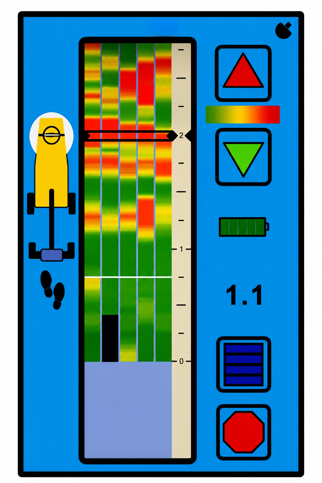
Rather than showing a conventional radargram, e-Safe processes the radar response and presents information through a purpose-designed operator interface.
Graded likelihood
The display indicates different levels of likelihood so the operator can identify areas requiring further attention.
Trackback support
The operator can reposition the equipment over an indicated point of interest for marking and further investigation.
Adjustable operation
Available controls support operation across different ground conditions and site environments.
Indicative information
The displayed information supports risk assessment but does not confirm the target material or provide excavation clearance.
Typical Uses
Utility avoidance before localised excavation work
The application is suited to checking defined work areas where excavation or ground penetration is planned.
Trial holes and excavations
Scan around the proposed excavation location before breaking the surface or opening a trial hole.
Street and highway works
Add GPR information before excavation, coring, drilling or other intrusive work within roads and pavements.
Construction sites
Review defined work zones where plans may be incomplete or where additional confidence is required before excavation.
Maintenance and repair
Support planned maintenance, service connections and repair work where buried infrastructure may cross the work area.
Important Safety Information
Utility avoidance equipment does not provide excavation clearance
A radar indication does not identify the target material with certainty, and the absence of an indication does not prove that the ground is clear. Performance varies with soil, moisture, target depth, target size, orientation and surrounding materials.
Results must be used together with available records, electromagnetic locating, competent site assessment, safe digging procedures and suitable physical verification.
Frequently Asked Questions
Common utility-avoidance questions
Contact UTSI for guidance based on the intended work area, expected services and site conditions.
Is utility avoidance the same as utility mapping?
Does e-Safe replace a cable locator?
Can utility-avoidance GPR detect plastic pipes?
Does the operator need to interpret radargrams?
How deep can the system investigate?
Can a clear display be treated as confirmation that excavation is safe?
Discuss Utility Avoidance
Add GPR information to your pre-excavation process
Tell us about the intended work area, expected utilities, site conditions and operating requirements.